About the Professorship
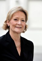
 Professor Barbara Koch has held the chair for Remote Sensing and Landscape Information Systems since 1994. With her appointment, Mrs. Koch took over research and teaching in the field of remote sensing and established the Department of Geographic Information Systems and Geomodelling at the former Faculty of Forest Sciences in Freiburg.
Already in 1997, she worked on the use of pulsed airborne and terrestrial laser data for the analysis and description of vegetation or vegetation structures. The work of the Chair played an international pioneering role for the detection of tree vegetation. In this context, the chair developed numerous algorithms and a software (TreesVis). Ms Koch is member of the Scientific Committee in many of the relevant scientific conferences and she is a reviewer for national and international journals.
Since 2005, she manages the Steinbeis Research Center “FeLis” which transfers scientific knowledge into industry applications.
Ms Koch was Women's Representative of the Faculty, member of the University Budget Committee, Vice-Dean and Dean. As dean, she was responsible for the conversion of the former Faculty of Forest and Environmental Sciences into the Faculty of Environmental and Natural Resource and had to implement the realignment of teaching and research as part of the expansion of the faculty. At this time, she is Academic Dean of the Faculty of Environment and Natural Resources, board member of the Centre for Renewable Energy, Head of the working group on Education of the University Centre for Sustainability and Transformation and Vice-Chairwoman of the Senate commission. In these roles, she works on the tri-national Science offensive for Environment and Sustainability. As a member of the Steering Committee of the Fraunhofer Research Institutes Freiburg, she is furthermore involved in the development of the cooperation between the Fraunhofer Institut and the University in the area of research and teaching. More
The current Professorship of Remote Sensing and Landscape Information Systems in the Faculty of Environment and Natural Resources is closely connected to the professional and private career of Prof. Dr. Dr. h.c. G. Hildebrandt.
 |
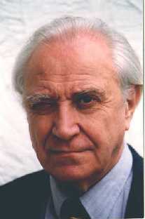
| Prof. Dr Dr.h.c.. G. Hildebrandt |
In 1957 Hildebrandt, at that time lecturer in geodesy and aerial forest photography in the Faculty of Forest Science at the Humboldt University in Berlin, was forced to flee with his family from the former German Democratic Republic to the West because of the threat of political persecution. He was accepted quickly and unbureaucratically in Freiburg and was able to continue his teaching and research at the Institute of Forest Management and Economy under Prof. K. Abetz. Within the framework of the lectures on Forest Economy, Hildebrandt was then dealing with the application of aerial photographs, which, over the course of several years, he developed into a separate lecture series, which was first offered in the summer term of 1962. In 1965 Prof. G. Speidel took the chair in Forest Management and Economy which led to a separation in the Institute due to space limitations. Provisionally a Section for Aerial Photogrammetry and Interpretation was created within the Institute and this became official in 1969 when Hildebrandt was fipsappointed professor,


